Access your favorites, share your photos and more.
Mont Edouard
 Waze
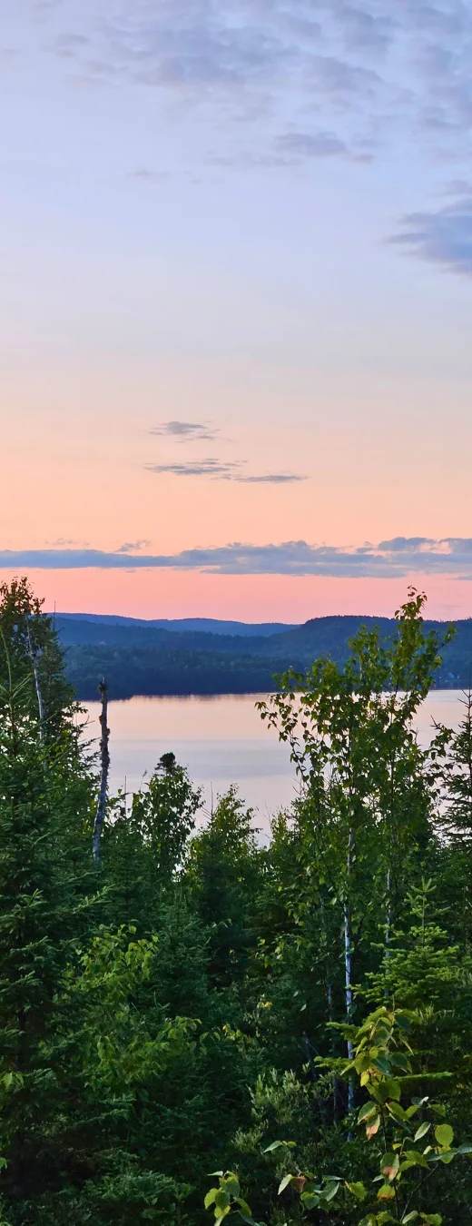
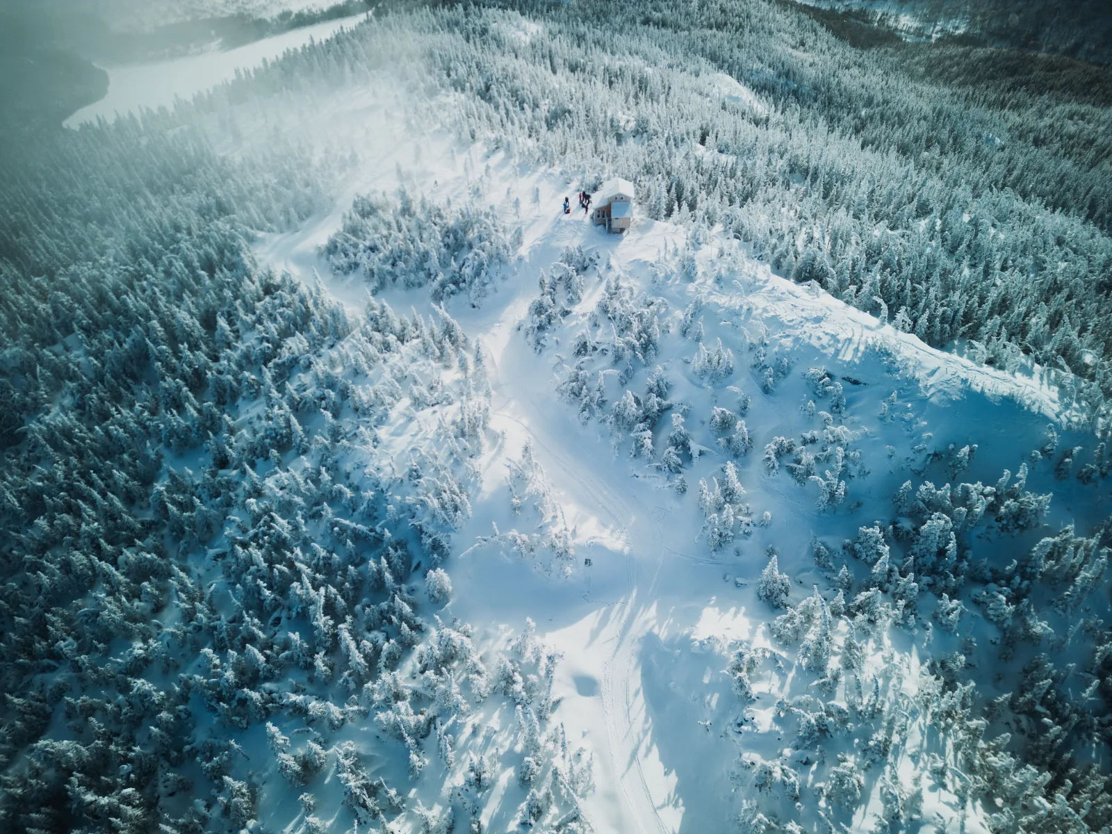
WazeMont-Edouard, located in L’Anse-Saint-Jean in the Saguenay–Lac-Saint-Jean region, is a year-round outdoor destination. Winter: downhill skiing, backcountry skiing, cross-country skiing, snowshoeing, and fat biking. Summer: hiking, mountain biking, platform camping at the summit, and a scenic overlook. A spectacular mountain setting overlooking the fjord.
Gallery
Add your photos or videos
Know this spot? Share your real photos: credited to you, in your personal gallery. The best ones replace the listing image.
🎥 Your videos come straight from your social networks (TikTok, Instagram, YouTube, Facebook): they stay linked to your account and point back to your channel — more exposure for you, and a livelier listing.
🌦️ 7-day forecast
Why go
Visiting Mont Edouard means immersing yourself in an exceptional natural setting. The variety of activities on offer—ranging from downhill skiing to mountain biking—attracts outdoor enthusiasts. What’s more, the beauty of the Saguenay–Lac-Saint-Jean region’s landscapes offers a relaxing and invigorating atmosphere, perfect for recharging your batteries.
What to do
- Hiking: Explore the marked trails and admire the local flora and fauna.
- Downhill skiing / snowboarding: Enjoy the snow-covered slopes for thrilling runs.
- Mountain biking: Ride trails suitable for cyclists of all skill levels.
- Snowshoeing: Set out on an adventure on snow-covered trails with snowshoes.
- Fat biking: Explore the winter trails on a fat bike.
- Lookout: Admire the panoramic views from the lookouts. An observation tower is also accessible at the top of the mountain.
Nearby
While you're in the area, explore the charming village of L'Anse-Saint-Jean, known for its spectacular scenery and water activities. Be sure to visit Saguenay Fjord National Park, which offers hiking trails and impressive lookout points.
Getting there
To get to Mont Edouard, take Route 170 from Saguenay or Charlevoix. Parking is available on site, making it easy to access the various activities and services.
Good to know
The best time to visit Mont Edouard is from June through mid-October for summer activities, while winter is perfect for skiing and snowshoeing. Be sure to bring the appropriate gear, including weather-appropriate clothing and water. Reservations for activities may be recommended during peak periods.
Safety tips
When participating in activities, be sure to wear warm clothes and check the weather forecast.
Community photos
Tap a photo to like, comment and see the photographer’s gallery.
🎥 Videos · 1
Skier au Mont Edouard
Shared by Marilyn Fortin
At a glance
Information
Characteristics
Things to do
Services & amenities
Site services
Site types
Atmosphere
Languages
The stay
Practical info
Leisure & amenities
Services and activities
Water activities
- Plage à proximité
Land activities
- Hiking
- Mountain biking
- Volleyball de plage
- Fatbiking
- Ice skating
- Snowshoeing
- Ski alpin / planche à neige
- Cross-country skiing
Recreation & discovery
- Belvédère
Equipment rental
- Fatbiking
- Mountain biking
Facilities
- Abri pour manger
- Accès Internet : connexion disponible
- Accès Internet : sans fil gratuit
- Bac de recyclage
- Bloc sanitaire
- Bois
- Boutique / comptoir de vente
- Douches gratuites
- Eau potable courante
- Électricité
- Électricité - 15 ampères
- Électricité - 30 ampères
- Lavabos
- Restrooms
- Nomad stop (vanlife)
- Camping d’hiver — Emplacement pour véhicule récréatif
- Camping d’hiver — Halte nomade (espace vanlife)
- Camping d’hiver — Prêt-à-camper
Food & dining
- Picnic area
Services
- Animaux de compagnie admis
Source: SIT Québec (Tourinsoft) — open data CC-BY 4.0.
Hiking
Hiking trails nearby
- 2 km
- 3.3 km
- 2.4 km
- 2.3 km
- 1.3 km
Trails located nearby — data © OpenStreetMap contributors (ODbL). Distances computed from OSM tracks; verify on site.
Good to know
Frequently asked questions
How do I get to Mount Edouard?
Are pets allowed?
What's the best time of year to visit?
Is there parking available?
How difficult are the trails?
What services are available on site?
What activities are available at Mont Edouard Resort?
Are there any on-site lodging options?
Can I rent equipment for the activities?
What dining options are available on site?
Are there bike rental services available on site?
Community reviews
Be the first to review this spot!
🥾 Hiked here? Rate this trail, set the difficulty and share your photos.
Want us to feature your place?
Invite the Plein Air Québec team to discover your establishment, lodging or activity.
We can travel to your location to live the experience, take photos and videos and create an authentic feature, published across the entire Plein Air Québec Network: websites and social media.
Fill out this form to help us better understand your proposal.
Data source: Données Québec — SIT Québec (CC-BY 4.0) · CC BY 4.0 (data modified and enriched)
Explore more
Discover more in Saguenay–Lac-Saint-Jean